2-9. Add a WMS data source
Add a WMS layer using the direct connection flow.
- On the Layers tab, add a new interface group called
Land Cover. - Inside it, add a layer card called
World Cover 2021with a suitable description (e.g. "Classification of land cover from Sentinel 2 data") and attribution ("ESA World Cover", https://esa-worldcover.org/en). - On the card, select + Add dataset.
- Choose Direct Connection → Add WMS.
-
Paste the following into the Service URL:
https://mapproxy.terrascope.be/mapproxy/service -
Paste the following into the Layer name:
esa-worldcover-map-10m-2021-v2_map -
Export your current configuration so that you have a saved copy.
-
Select Preview. The World Cover WMS renders on the map with your chosen attribution and description in the info panel. Your configuration should now look something like this.
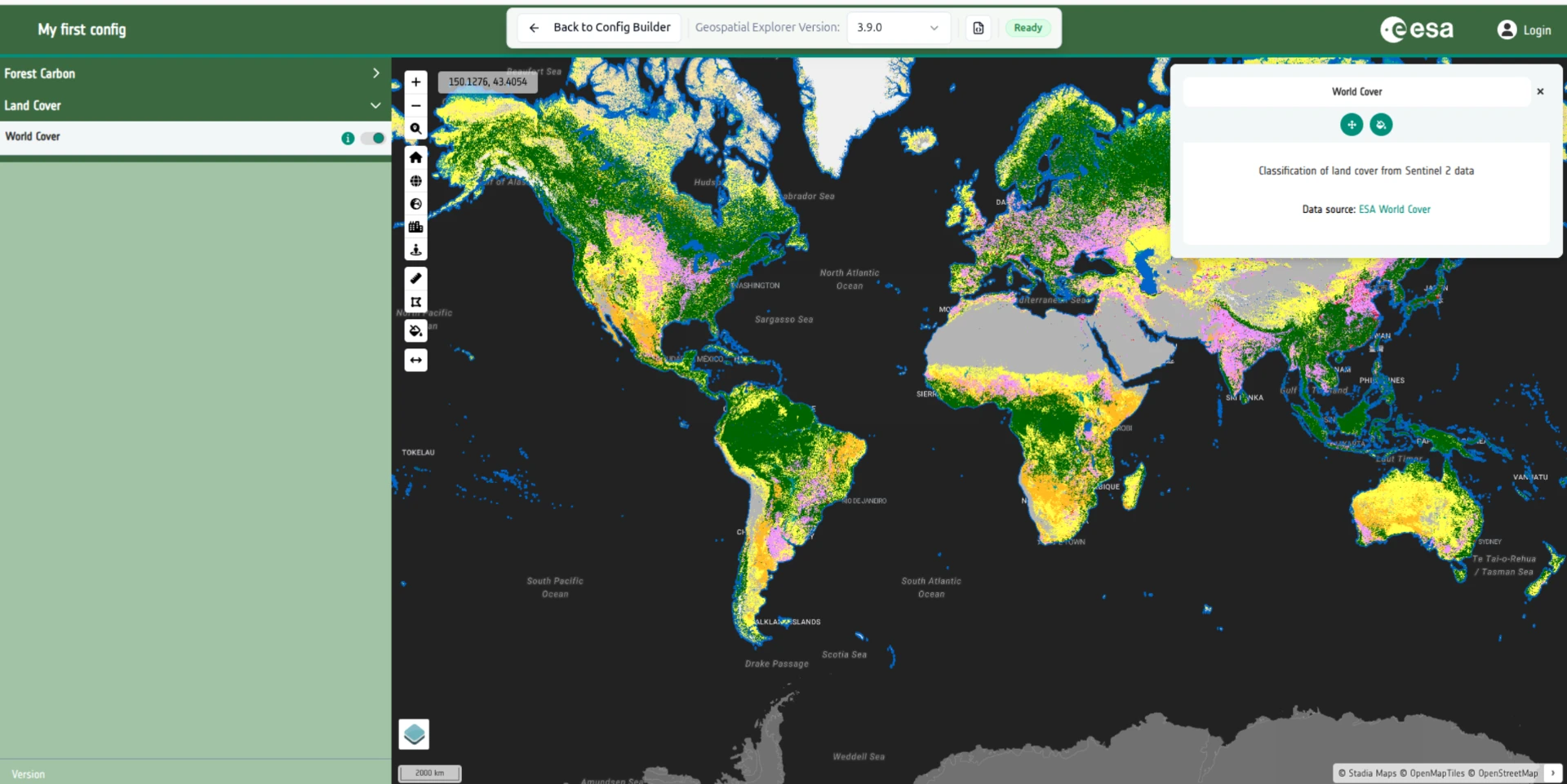
No legend yet
You will notice that there is no legend for this layer, so it is hard to understand what the colours mean. We will address this in tutorial 5 - working with categorical data.
See WMS / WMTS / WFS for the full reference.