8. Statistics
Tutorial Objectives
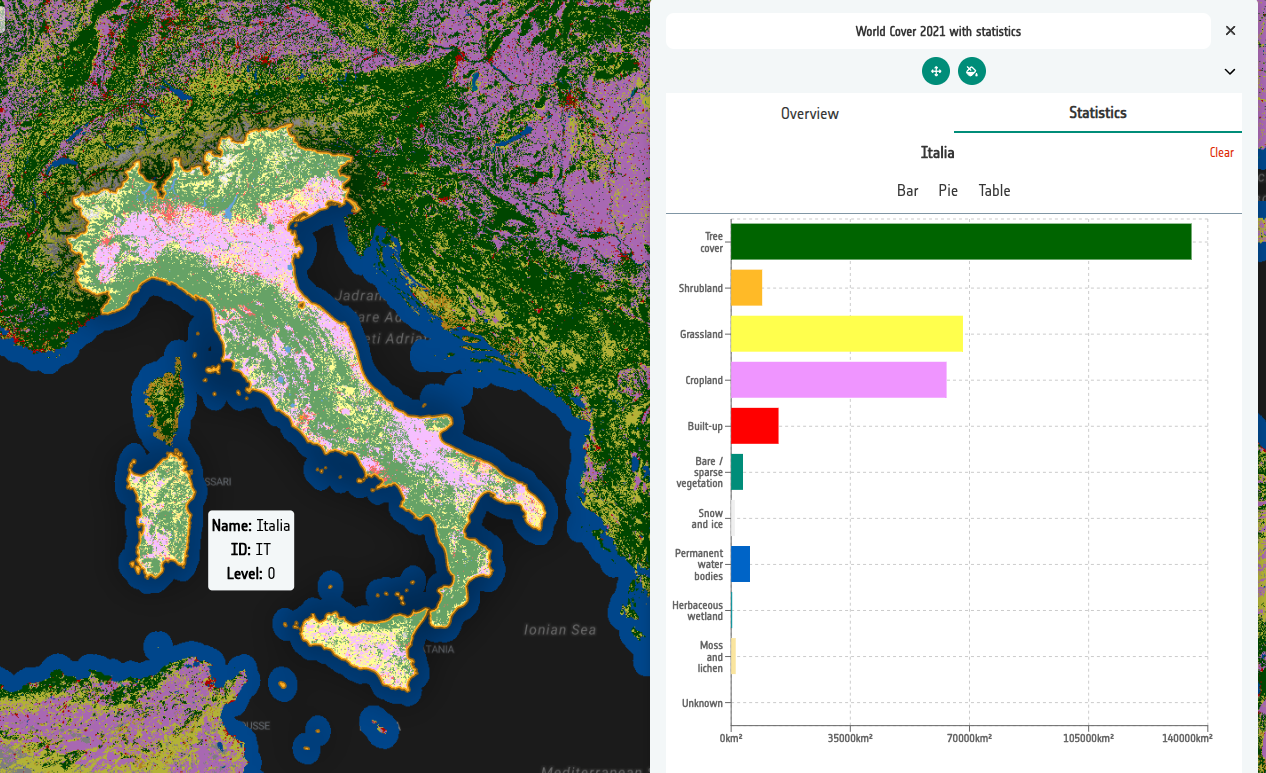
Add pre-computed zonal statistics to a land cover layer, so users can click an administrative area and see a breakdown of the data within it.
By the end of this tutorial you will be able to:
- Explain how statistics sources differ from a layer's display data.
- Add vector (FlatGeoBuf) statistics sources to a layer.
- Use the level property to serve different boundary detail at different zooms.
- Configure the layer so the Statistics tab is useful in the Explorer.
- Review and troubleshoot the resulting configuration.