2-7. Add a COG data source
In this step we will attach a Cloud Optimized GeoTIFF (COG) to your Above Ground Biomass layer card.
- On your layer card, select the Datasets tab and choose + Add dataset.
- Keep Direct connection and COG selected as the data format.
-
Paste the following into the Data source URL and select Add source:
https://eoresults.esa.int/d/FCM-AGB-100m/2023/01/01/FCM-AGB-100m-2023/FCM_Europe_demo_2023_AGB.tif -
The data source is now listed on the Datasets tab.
-
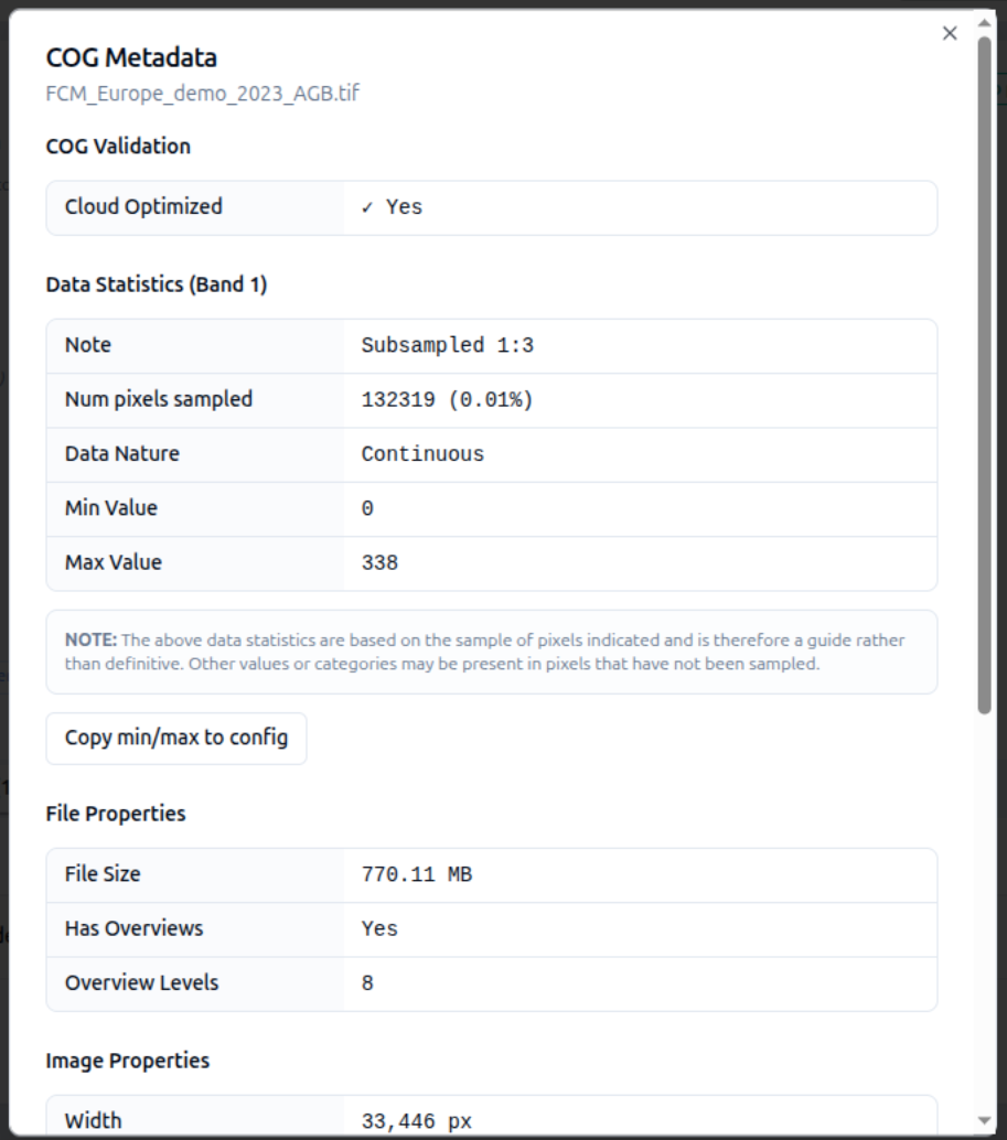
Click the (i) info icon on the row to interrogate the COG's metadata. Take a general look at what is reported — whether the file is cloud optimized, the file size, overviews, and the image properties.
-
Make a note of the min and max pixel values — you will need them in the next step — then close the dialog.
You've added your first layer!
From here you can add more data, restyle it, and layer in more advanced controls.
See COG for the full COG source reference.