11-2. Key concepts
- A CRS (Coordinate Reference System) defines how coordinates relate to locations on the Earth. A projected CRS also defines how the curved surface of the Earth is represented on a flat map. Because there is no single "right" way to do this, many different CRS exist, each suited to different regions, scales and purposes.
- By default the Geospatial Explorer displays maps in EPSG:3857, also known as Web Mercator. This is the most common CRS for web mapping services worldwide — it is what tile services like OpenStreetMap and most commercial basemaps use — which is why it is the Explorer's default.
-
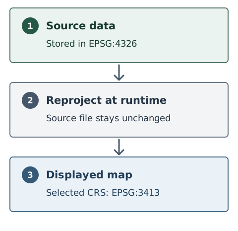
The Explorer can reproject data between supported Coordinate Reference Systems. If a dataset is stored in a different CRS, it is transformed at runtime so that it lines up correctly with everything else on the map.
-
This means you are not limited to data stored in Web Mercator: you can use datasets kept in another CRS, and/or change the CRS used for display — for example a polar stereographic view when working with Arctic data (see 11-3).
-
A number of standard CRS are included with the Explorer:
Code Name EPSG:3857 WGS 84 / Pseudo-Mercator (default) EPSG:4326 WGS 84 EPSG:3035 ETRS89-extended / LAEA Europe EPSG:3413 WGS 84 / NSIDC Sea Ice Polar Stereographic North EPSG:3031 WGS 84 / Antarctic Polar Stereographic EPSG:32601–32660 WGS 84 / UTM zones 1N–60N (northern hemisphere) EPSG:32701–32760 WGS 84 / UTM zones 1S–60S (southern hemisphere) -
If the CRS you need is not in that list, additional CRS can be defined in the Configuration Builder (Settings → Custom CRS) by supplying a PROJ.4 definition — the standard one-line definition of a CRS. A custom CRS can be used in two ways: to support datasets stored in that CRS, or as the default CRS for the whole map.
See Settings for the full reference on default and custom CRS.